Geospatial Solutions Services
Expert surveying and mapping services for construction, land management, and infrastructure projects.
1️⃣ GIS Mapping & Spatial Analysis
2️⃣ Remote Sensing & Aerial Surveying
3️⃣ 3D Digital Elevation Models (DEM) & Terrain Analysis
4️⃣ Cadastral Mapping & Land Surveying
5️⃣ Total Station & DGPS Surveys
6️⃣ Contour Mapping & Topographical Surveys
7️⃣ Geospatial Data Integration & Analysis
8️⃣ Utility & Infrastructure Mapping
Precision in Geospatial Solutions
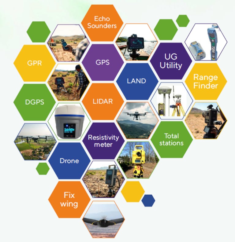
we specialize in Total Station Survey, GIS Mapping, Drone Survey, and Contour Mapping, providing high-precision geospatial solutions for construction, land management, and infrastructure development. Using advanced technology, we ensure accurate data collection, efficient project execution, and reliable mapping insights to support engineering, urban planning, and environmental management.


Who We Are
At NPLUS SOLUTIONS, our goal is to deliver reliable, high-quality geospatial solutions tailored to client needs. We ensure precise data collection and efficient project execution, leveraging advanced surveying and mapping technologies. Our expertise in Total Station Surveys, GIS, Cadastral Mapping, Drone Surveys, and Contour Mapping allows us to provide accurate, data-driven insights for infrastructure, land management, and development projects
N PLUS SOLUTIONS
Mapping the Future with Accuracy.
Mapping
+91 9979589533
© 2025. All rights reserved.