Installing Emergency Sirens Smartly: How GIS Ensures No One Is Left Behind
In today’s uncertain world, emergency preparedness is more important than ever. Many government agencies are taking steps to install public sirens — loud warning systems designed to alert communities in case of war, natural disasters, chemical leaks, or air raids. But the big question is: Are these sirens reaching everyone?
MEHUL TUVAR
5/14/20251 min read
Installing Emergency Sirens Smartly: How GIS Ensures No One Is Left Behind
In today’s uncertain world, emergency preparedness is more important than ever. Many government agencies are taking steps to install public sirens — loud warning systems designed to alert communities in case of war, natural disasters, chemical leaks, or air raids. But the big question is: Are these sirens reaching everyone?
In many areas, sirens are installed randomly — placed where it’s easy, not where it’s effective. This leads to a serious flaw: some areas may not hear the alert at all. That’s not just a technical issue — it’s a risk to public safety.
🔍 The Role of GIS and Proximity Analysis
This is where GIS (Geographic Information Systems) and proximity analysis become critical tools.
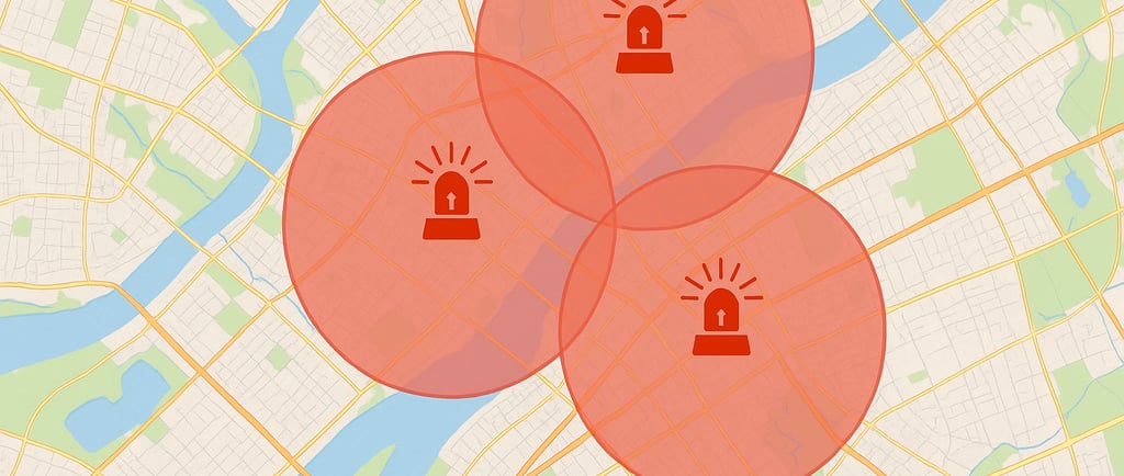
Using GIS, we can simulate the sound coverage of each siren — showing exactly how far its alert can be heard. With buffer analysis, planners can visualize the reach of existing sirens, identify coverage gaps, and determine the best locations for new installations.
The goal? To make sure that every street, every home, every person falls within the siren’s audible zone.
📡 A Real-World Parallel: Mobile Tower Placement
Think about how mobile towers are installed. Telecom companies don’t place them randomly — they use GIS and signal range models to ensure full network coverage. If towers are placed without analysis, some areas get no signal, leading to customer complaints and service gaps.
The same logic applies to siren placement. Random installation leads to sound blackouts, which during an emergency, could be the difference between safety and danger.
✅ Smarter Planning, Safer Cities
With GIS, authorities can:
Map current and future siren locations
Ensure 100% area coverage with minimal overlap
Optimize costs by avoiding unnecessary installations
Increase public trust by ensuring every person is within range
At NPLUS SOLUTIONS, we help civic bodies and agencies use GIS for smarter infrastructure planning — from siren systems and utilities to transportation and environmental projects.
Let’s make every alert count.
📧 Contact: info@nplussolutions.in
🌐 Visit: www.nplussolutions.in
N PLUS SOLUTIONS
Mapping the Future with Accuracy.
Mapping
+91 9979589533
© 2025. All rights reserved.